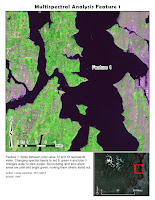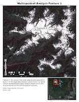

In Lab 7 we learned to locate and identify surface features based on their pixel value. Using tools provided by ERDAS Imagine Histogram tool I found the specific peaks in pixel values. Then using the Inquire Cursor I located areas on the image that matched those pixel values.
Then I identified those areas, and adjusted color bands to bring out areas of interest from their background. In the case of the second map, the snow capped mountain peak, no adjustment from true color was needed. This is because white snow cap clearly stands out from the mountain and vegetation color. Third image is that of shallow water with heavy sediment load. The challenge was to bring out the sediment pattern in the water. Under most band variations the sediment pattern was very difficult or impossible to distinguish from deep water. However using red 4, green 2 and blue 1, the eddies in the water popped out very clearly.

No comments:
Post a Comment