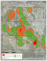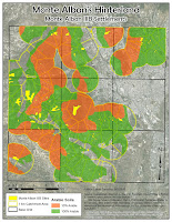
 My final project examines increase of catchment area of a community through creation of satellite communities. I examined Monte Alban IIIA and IIIB periods in the area directly around Monte Alban itself.
To get the data I needed, surface area statistics, I georeferenced and digitized the soil maps, then created separate shapefile with only the arable areas. Next I digitized the sites and created 1 Km buffer around them to represent the catchment area. The important part of this step was to "dissolve all" buffer zones, in order to create a single large area, rather than a number of overlapping circles. Then I clipped the soil map to the catchment area, create Thiessen polygons to divide the catchment area between all sites, and calculated surface areas for various types of soils.
No comments:
Post a Comment